When you imagine a person who manages a fleet of vehicles, you may see someone who sits watching a GPS map all day. Perhaps that’s true, but fleet managers with geofencing have figured out the secret NOT having to “map watch”. That’s because geofence data automates map scrutiny by ONLY sending you alerts when there’s something worth noting.
What geofencing is in simple terms… It’s the automation of map visibility according to custom digital fences drawn on a map that alert you to entering or exiting those boundaries.
This isn’t some new technology—it’s actually been around since the nineties. Still, too many fleet managers fail to recognise its potential. Geofences support your fleet management efforts in ways you never thought possible, which is why Cartrack is exploring this fascinating technology.
This is everything geofencing is created to do, and why you need it starting from TODAY.
Geofencing in fleet management is the act of setting up a virtual boundary that alerts you when that boundary is crossed, entered into, or exited out of. You can draw it with your mouse cursor, or simply create a perfectly round geofence around a certain city or suburb.
If you deem an area or route unfit for your drivers to enter, or want to keep them “fenced in” within a certain area, geofencing helps you do that.
And no, you won’t have to sit and watch a map all day. Geofences work with alerts to notify you when those boundaries have been crossed or violated.
In fleet management, geofencing is used to monitor vehicle, driver, and asset movements. It also allows you to see when drivers deviate from recommended routes. Geofencing helps shipping companies see when packages leave warehouses and get notifications of the movements of their orders.
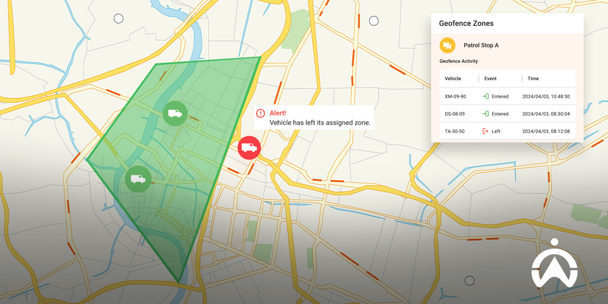
Geofencing in cars management is used to keep drivers within a certain area, or at least alert the dispatch manager if & when they move out of or into that area. Safety is the biggest motivator for using this data, but there are other operational benefits too.
Geofencing is a way to organise a route or a location, and assign criteria to both. Let’s look at safety and operational uses.
Are there some areas you don’t want your drivers to go? Do some of your drivers take shortcuts through a dangerous location to complete their jobs quicker?
Management tool: Simply mark that location with a geofence boundary and set alerts to notify you in real time if that boundary is crossed.
This allows you to quickly correct your driver and redirect them through areas you deem safe for them and for your vehicles.
Are your drivers only allowed to operate within a certain suburb or city? What if they’re moonlighting after hours and using your vehicles to do so?
Management tool: Create a permanent geofence perimeter for the area they should stay in and set your alerts to notify you if a vehicle leaves that location.
Now you’ll immediately know (and have a record of) any driver that leaves a designated area with one of your vehicles.
Geofencing is a great way to update your team on trip progress. You can mark various points on your map and get alerted to when your drivers arrive within certain location points.
Management tool: Set multiple geofences across various stop points so you can measure when your driver reaches a certain location. You can even record the time it took them to get there to monitor segmented durations of each trip.
You’ll have valuable tracking data that can be used to determine how long certain trips take, and you’ll stay updated on how far your drivers are based on each location they reach.
If you don’t already have a workforce optimisation system that automates ETA updates to your clients, you can use geofencing to set up your own ETAs. By marking various map spots en route, or simply marking one location close to a destination, you can keep your customers updated on an arrival.
Management tool: Create a perimeter around the destinations of your drivers. Once they enter into the radius of that destination, you’ll get an alert. You can now message your customer and let them know that your vehicle will be arriving within a certain time.
When your customers are consistently kept in the loop, it does a lot for your reputation and brand loyalty.
Geofencing isn’t that impressive until you realise that it can be contextualised in various ways. A type of strategy is enforcing speeding limits on your drivers. If they’re in a location where speed limits are high, you can mark those as such. In suburbs and cities, you can set alerts for speeds over a certain level.
Management tool: Mark highway areas as high-speed zones. Now set urban areas as lower speed zones. If speed limits are violated, you’ll get an alert and can address it with the driver in question using the data you have.
Not only will this keep your fleet compliant with traffic laws, you’ll also improve your brand reputation because your drivers are held accountable for reckless driving.
Thanks to multiple location settings, geofencing is massively useful in delivery and logistics businesses. By monitoring which zones are reached and which are departed from, you can create a system that will track each vehicle and hold them to a schedule.
Management tool: Mark your delivery destinations with a geofence at the start of each morning. Now you’ll get alerts every time a driver arrives or leaves that destination, helping you manage their time and schedules—one task at a time.
This helps you complete your quota of deliveries each day and gives you the location data you need to keep your delivery recipients updated on progress.
A geofence alert is a real-time notification every time one of your vehicles crosses one of the virtual boundaries you’ve created. You can choose to receive these alerts in the form of an email or an SMS. For fleet managers, SMSs are convenient because they’re often not at their desks.
The point of geofencing is automating your dispatch processes. Fleet managers are tasked with monitoring drivers minute-by-minute. With geofencing data, much of this monitoring is done for you, because you get alerted when something demands your attention.
Alerts are also useful because you get them sent straight to your phone via SMS even when you’re not at your desk or even at the office.
Depending on how you’ve contextualised your alerts, you can take action in various ways once you’ve received one. Here are some real-world examples:
Geofencing requires two things: GPS tracking and fleet software. These two work together to enable geofencing in the comfort of your home or office.
To get started, simply contact our fleet helpline and ask about geofencing software. Scroll further down if you want to learn about a type of technology you can add to make geofencing even MORE useful!
We could theorise how geofencing can be used, but after years in the industry, Cartrack has several real-world examples of how it’s ALREADY being used by large companies across the world.
The service industry is a fast-paced one. Service calls are on a strict schedule, and lateness isn’t tolerated by customers who make time to receive those calls. The solution? Geofencing!
Construction and mining companies use expensive equipment to get through essential tasks. Keeping track of that equipment is a full time job. With the right data, it’s much easier. The solution? Geofencing.
Check out some of the scenarios where a geofence helps boost operations, starting with one of Cartrack’s long-standing clients, Servcare Pest Control.
Servcare Pest Control in Singapore revolutionised their business with multiple data software solutions from Cartrack, one of which was geofencing. They use it for real-time monitoring of their drivers who enter & exit key work sites.
This helps them make the best dispatch decision at the moment, which reduces each driver's time on the road. They reach their appointment destinations faster because they've optimised scheduling based on the location of each driver and the clients for that day.
In offering a range of private security protection services, BCI Security had no way of ensuring their response units remained within their assigned areas. This prevented their control room from being as quick and efficient as possible in emergencies. Their dispatchers needed a system to help them instantly locate their vehicles and monitor driver behaviour.
How we helped them:
Cartrack’s geofencing feature allows BCI to set virtual parameters around assigned areas and alerts them when drivers enter or leave those zones. This helps them ensure their response units are always active and present in their assigned areas. They can respond to client emergencies as quickly as possible, and their geofence reports are useful in giving BCI clients an accurate indication of patrol activity.
“Cartrack suited and understood our business from the start. We feel much safer with the Cartrack system, and their service is great, you are not just a number with them. Without them, we just wouldn’t be as efficient.” Johnny Loots | CEO, BCI Security
Geofences aren’t just for vehicles. Construction and mining companies around the world use Cartrack’s geofencing to keep track of their equipment. If a tool or machine moves out of a set radius, managers are immediately alerted to suspicious activity.
Because these companies use so many different kinds of machines, vehicles and tools, having geofencing software allows them to manage that equipment with data, without having to check each physical location every 5 minutes.
NOTE: We don’t usually use GPS tracking to monitor equipment. Instead, Cartrack uses a much more convenient tracking device called the CT tag, which provides all the data you need for geofencing your equipment.
Security is already predisposed to all sorts of danger. Geofencing helps to minimise some of the danger by keeping dispatchers updated on where each vehicle is, and which security teams are in need of special monitoring.
The time and location of arrivals are useful data points for security companies—especially when that data is delivered in real time!
To keep a town running, the government uses various departments to service residents. This can be anything from a postal service to garbage collection. Utility workers also rely on prompt communication that’s relevant to the location they’re in.
It’s almost impossible to manage this efficiently without the help of fleet and geofencing technology. Instead of needing a team of overworked dispatch managers, one person can manage a whole fleet of service providers all tied into one simple system.
Imagine being able to place roadblocks wherever you want at a whim. Every time you become aware of a route that’s less-than-optimal for your drivers, you could simply snap your fingers and barricade a road.
In a way, that’s exactly what geofencing lets you do. Virtual boundaries placed in strategic places tell your drivers in real time which routes to avoid.
Hundreds of delivery companies use Cartrack’s geofencing technology to keep their drivers on optimal routes, and their dispatch managers get notified if a driver isn’t sticking to the plan.
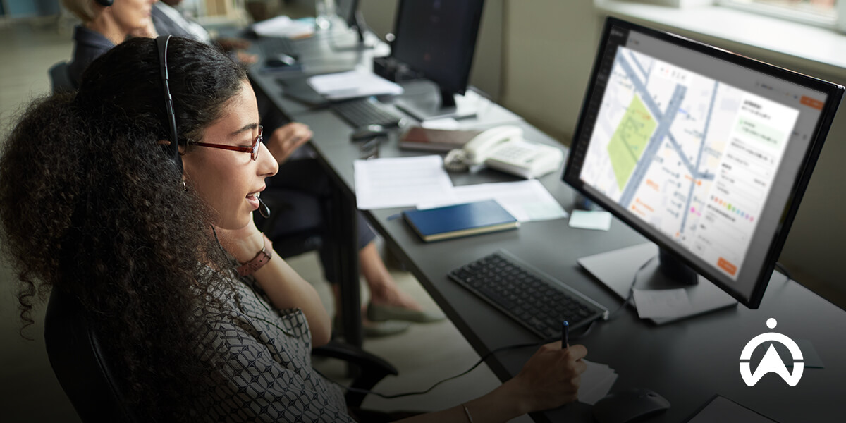
We’ve seen how geofencing is used as a standalone technology. But its abilities are greatly enhanced when you combine it with other fleet management solutions.
Vehicle safety, fuel saving and workforce optimisation are all included in Cartrack’s various packages, so if you want to enhance your business operations, consider the following friends of geofencing.
When you have tracking and vehicle recovery on your vehicles, geofencing can act as an early warning system. When you’re familiar with where your vehicles operate and where they should be, you can create zones that warn you when they’re outside of those areas.
Cartrack perk: When you fit a tracking device to a vehicle at Cartrack, vehicle recovery is part-and-parcel of your tracking contract!
Courier, delivery, logistics and mobile service companies all benefit greatly from geofencing. Once you get used to our system you’ll find new ways to make your life as a fleet manager easier, because alerts will be sent every time a delivery is done or each of your drivers is leaving a location.
Cartrack perk: Cartrack’s Delivery software comes with geofencing as part of the platform, along with various other perks like:
Geofencing pairs well with fuel monitoring because you can alert yourself to when drivers are filling up, or spending too much time in one location. Once you combine geofencing strategies with fuel monitoring, you’ll start noticing less travel time on all your vehicles and better route utilisation.
Cartrack perk: We also offer real-time route optimisation that dynamically changes according to real-time events like heavy traffic congestion or spontaneous road blocks.
There are several companies that offer geofencing technology, and Cartrack remains one of the pioneers in the industry. We’ve created inventive ways to solve real-world fleet challenges using geofencing, and all you need to do is tap into our existing solutions.
Here’s how to create a geofence on the Cartrack platform:
Your geofence is now created! Feel free to create more as you need them, and be sure to set alerts for each one according to its purpose.
If you need any further help, feel free to chat with us on WhatsApp.
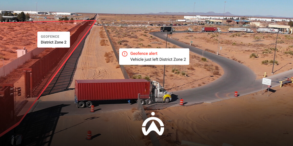
Learn about the amazing technology of geofencing and how it can simplify your day-to-day fleet operations and save you time.